
Reviewed · HIKING & TREKKING
Santiago: Monte Tchota Natural Park to Pico d’Antónia Hike
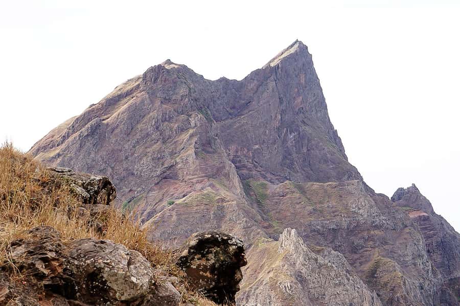
Santiago rises into the clouds. This six-hour hike takes you from Rui Vaz through the cool, green heights of Monte Txota Natural Park to Pico d’Antónia, the island’s highest point. I like the mix of plant life, high-altitude air, and broad views toward São Jorge Valley, Maio, and Fogo. I also like that transport, a guide, insurance, and a simple picnic are included. The main caution is clear: this is a difficult walk with narrow, tilted paths and sections that may require basic climbing.
The guides have earned especially strong praise for setting a steady pace and helping when the trail gets tough. Elder is singled out for his calm support, safety awareness, and clear explanations of the plants and scenery. You should still come prepared, since 9 kilometers, around 660 meters of ascent, and up to 1,280 meters of descent make this far more than a gentle nature walk.
In This Review
- Key things to know before you book
- Starting in Rui Vaz and climbing into Monte Txota
- The route to Santiago’s highest point
- Views from Pico d’Antónia
- The descent and return to Monte Txota
- Guides, groups, and the pace of the day
- What to wear and carry for the 9 km trail
- Is the $100 price fair?
- Who should book this Santiago hike?
- My booking advice
- FAQ
- How long does the Monte Txota to Pico d’Antónia hike last?
- How far is the hiking route?
- How difficult is the hike?
- How much elevation does the hike involve?
- Where does the hike start?
- Can I see Maio and Fogo from the summit?
- What is included in the $100 price?
- What languages are available for the guide?
- Is the hike suitable for everyone?
Key things to know before you book
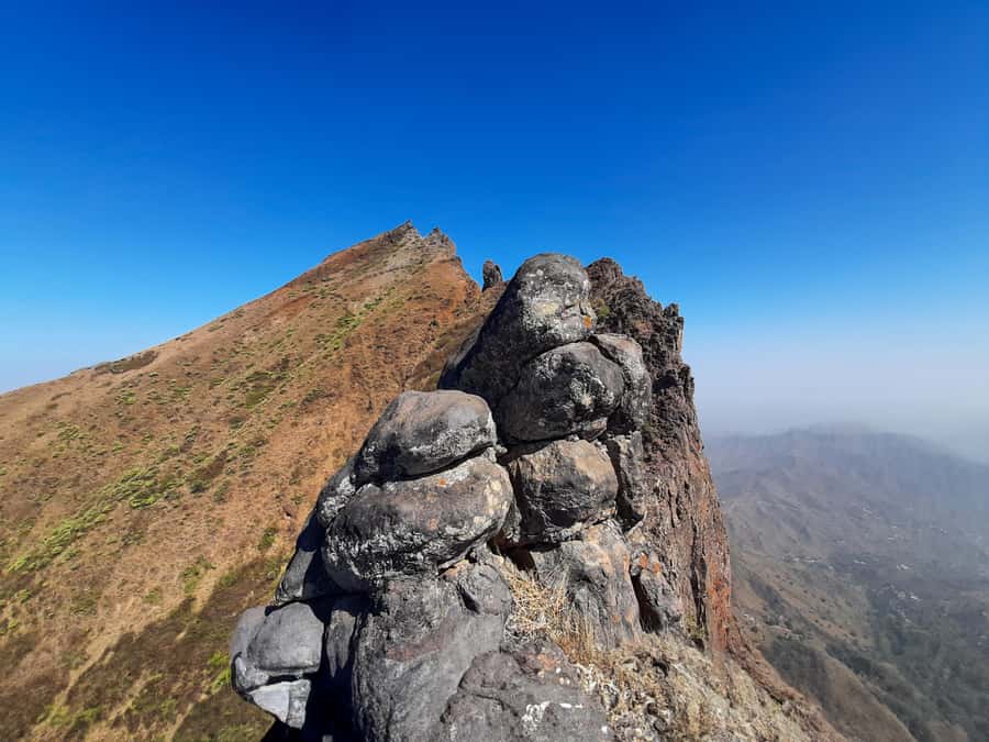
- Pico d’Antónia reaches about 1,394 meters, the highest point on Santiago Island.
- Monte Txota sits at about 800 meters, where a cooler micro-climate supports notable plant and animal life.
- The route covers roughly 9 kilometers, with four to five hours spent walking.
- The trail is one way and difficult, with narrow, tilted sections and possible level 1 climbing.
- Views may reach Maio and Fogo, but only when the weather is clear.
- The $100 price includes transport, a guide, insurance, and a picnic, making it more useful than a simple guided walk.
Starting in Rui Vaz and climbing into Monte Txota
Your day begins with pickup at your accommodation in Praia or São Jorge dos Órgãos, followed by a drive to Rui Vaz. The ride matters because it places you high on Santiago instead of using your energy on a long approach from the lowlands.
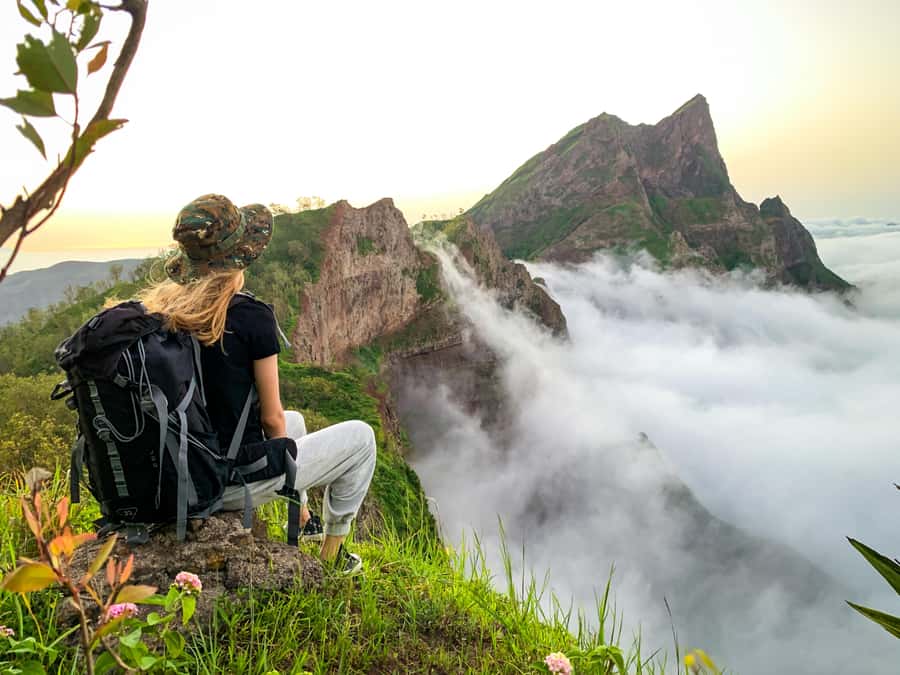
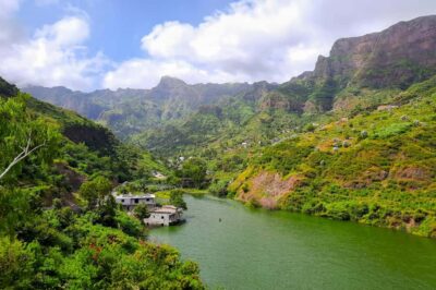
The hike enters Monte Txota Natural Park at roughly 800 meters. This height gives the area a cooler feel than much of Santiago, and its own micro-climate helps support a wider range of plant life. It is one of the most appealing parts of the outing for anyone who wants to see a less dry, more mountain-like side of Cape Verde.
I like this early part because it gives you time to settle into the pace before the most demanding sections. Your guide can point out the local biodiversity as you walk, and you get a better sense of how quickly Santiago changes with altitude.
The park is not simply a backdrop for the summit. It is a reason to choose this route instead of treating Pico d’Antónia as a basic peak-bagging exercise. You are walking through a distinct highland environment, not just up a bare slope.
Still, the cool air can be misleading. The temperature may feel pleasant, but you remain exposed to sun for parts of the route. Bring water, sunscreen, and a hat even if the morning begins under cloud.
More Hiking Tours in Santiago
- Serra Malagueta: Principal Valley Hike & Lunch with Locals
★ 4.7 · 64 reviews - Praia: Baobab Mysterious Tree, Green Valley & Old City Hike
★ 4.8 · 53 reviews - Santiago: Calabaceira Valley Trek & Visit to Cidade Velha
★ 4.8 · 49 reviews
The route to Santiago’s highest point
From Monte Txota, the trail continues toward Pico d’Antónia. At about 1,394 meters, it is the highest point on Santiago Island, so the climb has a clear purpose. You are not simply wandering through the hills. You are working toward the island’s top point and the views that come with it.
The published figures give the hike a useful shape: about 660 meters of elevation gain, followed by as much as 1,280 meters of descent. The total distance is around 9 kilometers, and the walking time is approximately four to five hours within a six-hour outing.
That descent figure deserves attention. Many people prepare for the uphill and forget that going down can be harder on the knees, thighs, and ankles. Hiking shoes are important, and walking sticks are a sensible addition. The organizers specifically advise hiking pants, especially from August through November, when the trail may involve more contact with vegetation or rough ground.
The route is described as difficult, with narrow and tilted paths. Some sections may require level 1 climbing, so you should be comfortable using your hands for balance and moving carefully over uneven ground. This is not the right choice if you want a broad, smooth path or an easy half-day stroll.
The guides are a major part of the experience here. Carsten’s feedback highlights a guide who stayed mostly at the group’s pace and offered useful help. Kevin specifically praised both the guides and the driver. Elder is praised for helping with difficult moments while keeping an eye on group safety. That combination matters on a trail where the challenge changes from one section to the next.
Views from Pico d’Antónia
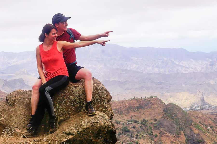
As you approach the summit, the reward becomes less about the effort already spent and more about how much of Santiago opens below you. From the high point, you can enjoy broad views toward São Jorge Valley and, in suitable weather, much of the island’s built-up areas.
The clearest days may also reveal Maio Island and the volcano on Fogo Island. These distant views are weather dependent, so they should be treated as a bonus rather than a promise. Cloud, haze, or mountain weather can reduce what you see from the top.
That uncertainty is part of mountain walking. The summit still gives you the satisfaction of reaching Santiago’s highest point, even if Maio and Fogo remain hidden. If the air is clear, though, the scale of the view adds real value to the day. You can look across Santiago and toward other Cape Verdean islands from one high ridge.
I would not book this hike only for a guaranteed panorama. Book it for the combination of Monte Txota’s cooler environment, the summit walk, and the chance of a wide island view. That makes the experience worthwhile in more than one kind of weather.
A small picnic provides a pause along the way. The included food is simple: a sandwich, fruit, and a soft drink. It is not a full meal, so you should still eat properly before pickup and carry extra water. The picnic works best as a practical break while you take in the scenery, not as a major food experience.
The descent and return to Monte Txota
The return portion is where the hike may test you most. The route involves a large loss of elevation, and a steep descent can feel more demanding than the climb. Your pace may slow, especially on narrow or sloping ground.
This is also where good guiding has the most value. A guide who watches the group, offers help, and adjusts the pace can make a difficult trail feel manageable. The positive feedback about Elder’s empathy and support is particularly relevant for anyone who is fit enough for the walk but not used to Cape Verde’s mountain paths.
The route ends with a return to Monte Txota Natural Park and then a ride back to your hotel. Since the walking route is described as one way, you are not simply retracing every step on foot. That helps keep the outing within its stated five to six hours, though the exact pace depends on the group and trail conditions.
Allow yourself a little flexibility after the excursion. The planned duration is six hours, but a difficult trail, pauses for views, and group pacing can affect the finish time. Drivers wait only five minutes after the scheduled pickup time in the morning, so be in your hotel lobby ten minutes early.
More walks:
- Serra Malagueta Natural Park Hike & Relaxing Swim at Tarrafal Beach
★ 5.0 · 30 reviews - Serra Malagueta Natural Park: Hike to Gongon Valley & Lunch
★ 4.8 · 22 reviews - Santiago Island: 4-Hour Calabaceira Valley Hike & Guided Tour to Cidade Velha
★ 5.0 · 18 reviews - Santiago: Trek from Serra Malagueta to Rabelados Community
★ 5.0 · 16 reviews
Guides, groups, and the pace of the day
You can book a private outing or join a small group. The shared group option requires at least two participants. If that minimum is not met, the operator may suggest another date, offer to run the hike privately for an added fee, or cancel and provide a full refund.
A small group is a good fit if you like some company but still want a guide who can keep an eye on everyone. A private walk gives you more control over pauses and pace, though the extra fee may change the value calculation.
Guiding is available in English, French, Spanish, and Portuguese. That is useful on a route where instructions about footing and movement matter. It also makes it easier to ask about the plants and local environment in a language you understand well.
The strongest praise centers on the human side of the outing. Guides are described as helpful, well informed, patient, and attentive to safety. One guide, Elder, receives particular credit for explaining the natural surroundings in a clear way rather than turning the walk into a lecture. That is the right balance for a demanding hike.
You should still be honest about your own fitness. The activity is intended for people with some fitness and no health problems. It is not suitable for pregnant people, wheelchair users, people with mobility impairments, or people with respiratory issues. It is also limited to participants over 16.
What to wear and carry for the 9 km trail
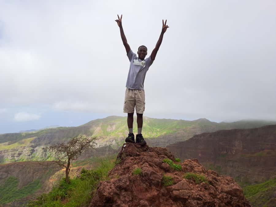
Your equipment will affect how enjoyable this day feels. Hiking shoes are essential because the trail is narrow and tilted in places. Ordinary trainers may not give enough grip or support for the descent.
Bring:
- Water and additional drinks
- A sun hat
- Sunscreen
- Hiking shoes
- Hiking pants
- Walking sticks if you use them
The advice about hiking pants is especially important from August through November. The trail may require careful movement through rough sections, and long trousers offer more protection than shorts.
Do not rely only on the soft drink included with the picnic. The activity information specifically tells you to bring water, and that is the advice I would follow closely. A six-hour day with four to five hours of walking and a substantial descent can use more water than you expect.
You should also avoid treating the stated picnic as your entire food plan. The sandwich and fruit are helpful, but breakfast before pickup remains a wise choice.
Is the $100 price fair?
At $100 per person, the cost is reasonable if you would otherwise need to arrange a vehicle, a mountain guide, and food separately. The package includes pickup and drop-off in Praia or São Jorge dos Órgãos, transportation, a guide, liability insurance, and the picnic.
The value is strongest for people staying in Praia who want a practical, organized route into Santiago’s highlands. Transport is not a minor extra here. The trail starts at Rui Vaz, so arranging your own transfer could be inconvenient, especially if you do not know the island’s roads.
The price is less simple for people staying elsewhere. Pickup and drop-off outside Praia require an additional fee, so confirm the final cost before booking. You should also ask about the private option if you are traveling alone, since the shared group requires at least two participants.
A rating of 4.8 from 43 verified bookings supports the idea that the service is generally reliable, especially the guiding and driving. It does not remove the need to judge the hike itself. A highly rated difficult walk is still difficult, and the physical demands should guide your decision more than the score.
Free cancellation up to 24 hours before departure and reserve now, pay later terms make planning easier. These policies are useful if your Santiago schedule is still shifting, but they do not change the main question: can you comfortably manage a narrow mountain trail and a long descent?
Who should book this Santiago hike?
I would recommend this outing to fit hikers who want more than city sightseeing and who value a guide’s support on rough terrain. It suits people interested in Santiago’s highland plants, cooler mountain conditions, and the chance to see several islands from above.
It is also a good choice if you want transport handled for you. The included drive removes much of the practical work and lets you focus on the walk.
You should think twice if you dislike steep descents, have breathing or mobility problems, or prefer a relaxed nature outing. The trail can require basic climbing, and the route loses a great deal of height. This is a serious day outside, not a casual walk with a view at the end.
Weather is another reason to keep expectations flexible. Maio and Fogo may be visible, but cloud or haze can block them. The park and the summit remain the core of the experience, while the distant islands are an added reward.
My booking advice
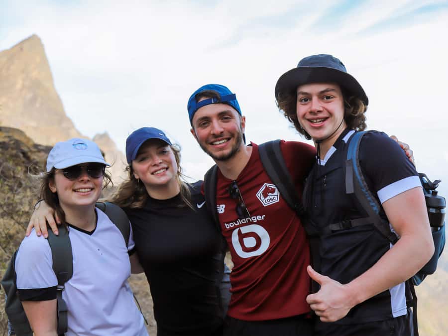
Book this tour if you want a demanding but well-supported mountain day and you are prepared for narrow paths, a 9 km route, and a long descent. The combination of Monte Txota’s highland biodiversity, Pico d’Antónia’s status as Santiago’s highest point, and possible views toward Maio and Fogo gives the outing real variety.
Skip it if you are not comfortable with difficult trails or if your health limits strenuous walking. For the right hiker, the $100 package offers solid value because it combines transport, guiding, insurance, and a picnic rather than leaving you to arrange each part yourself.
FAQ
How long does the Monte Txota to Pico d’Antónia hike last?
The full activity lasts about six hours. Walking takes approximately four to five hours, with time for transport, pauses, and the picnic included in the day.
How far is the hiking route?
The trail distance is approximately 9 kilometers.
How difficult is the hike?
It is classified as difficult. The route has narrow, tilted paths, significant elevation change, and sections that may require level 1 climbing.
How much elevation does the hike involve?
The route gains about 660 meters and loses approximately 1,280 meters. The highest point is around 1,400 meters, while the lowest point is about 485 meters.
Where does the hike start?
The day begins with a drive to Rui Vaz, where the trek starts before continuing through Monte Txota Natural Park toward Pico d’Antónia.
Can I see Maio and Fogo from the summit?
You may see Maio Island and the volcano on Fogo Island when weather conditions are clear. These views are not guaranteed because of cloud and visibility.
What is included in the $100 price?
The price includes pickup and drop-off in Praia or São Jorge dos Órgãos, transportation, a tour guide, liability insurance, and a picnic with a sandwich, fruit, and soft drink.
What languages are available for the guide?
Guiding is available in English, French, Spanish, and Portuguese.
Is the hike suitable for everyone?
No. It is intended for people over 16 with some fitness and no health problems. It is not suitable for pregnant people, wheelchair users, people with mobility impairments, or people with respiratory issues.
Just added around Praia
- Santiago Island: Private Airport Transfer to Praia or Vice Versa★ 5.0 · 3 reviews
- Cape Verde: Best Hikking Trails of Santiago Island – 6 Days★ 5.0 · 3 reviews
- Praia City Tours★ 3.4 · 3 reviews
- Hiking Águas Belas Cave★ 4.5 · 3 reviews
- Best of Santiago Island: Cidade Velha, Workshop & Tarrafal Beach Tour★ 4.5 · 3 reviews
- From Praia: Full-Day Guided Fogo Island Tour★ 4.2 · 3 reviews
- Tarrafal Bay Boat Trip and Beach Day★ 4.4 · 3 reviews
- Praia: Plateau and Cidade Velha Guided Tour★ 5.0 · 3 reviews
Hiking & Trekking, compared.

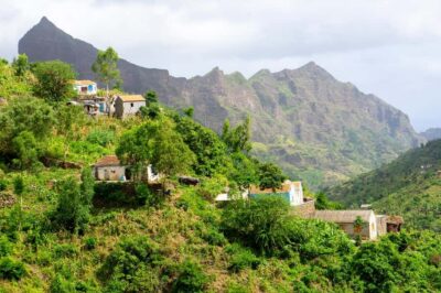
Serra Malagueta: Principal Valley Hike & Lunch with Locals
Read our review →
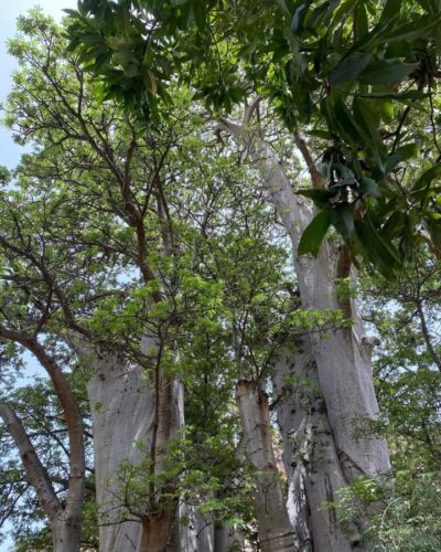
Baobab Mysterious Tree, Green Valley & Old City Hike
Read our review →
Browse the lists this tour appears in