
Reviewed · HIKING & TREKKING
Serra Malagueta Natural Park: Hike to Gongon Valley & Lunch
Mountain paths reward strong legs. This Serra Malagueta outing gives you high mountain views and a real look at life in Santiago’s remote valleys, not just a quick viewpoint stop. I especially like the walk from about 1,000 meters above sea level and the chance to share lunch with a local family.
I also like the practical setup: hotel pickup and drop-off from Praia, transport, a guide, lunch, and liability insurance are included. The main caution is the route itself. Twelve and a half kilometers, several steep descents, heat, and up to 1,100 meters of loss in elevation make this a serious hike, not a gentle nature stroll.
In This Review
- Key points to know before you book
- From Praia to Serra Malagueta at 1,000 meters
- Why the Serra Malagueta views are worth the effort
- The long descent through Gongon Valley
- Remote villages and a meal with a local family
- Continuing to Hortelã Valley
- How difficult is the Serra Malagueta hike?
- What is included, and is $106 a fair price?
- What to pack for a safer, better day
- Who should book this experience?
- Should you book the Serra Malagueta hike?
- FAQ
- Where does the Serra Malagueta hike take place?
- How long is the trail?
- How long do you walk?
- Is the hike difficult?
- What is the highest and lowest point?
- Is the trail a loop?
- Is lunch included?
- What should I bring?
- Is hotel pickup included?
Key points to know before you book
- A one-way mountain hike: You walk from the high Serra Malagueta area down through Gongon Valley toward Hortelã Valley.
- A demanding 12.5-kilometer route: Expect roughly four to five hours of walking, with about 580 meters of ascent and 1,100 meters of descent.
- Lunch with a local family: The meal is intended to be a picnic or home-style lunch, with food such as a sandwich, fruit, and juice, and local dishes may be served.
- Strong guide support matters: José, Katia, Cati, and other guides have been praised for kindness and care, though one account describes a rushed pace.
- Good wildlife and plant watching: Look for endemic plants, vervet monkeys, and gray-headed kingfishers.
- Bring proper gear: Hiking shoes, poles, water, sunscreen, a hat, hiking trousers, and a windbreaker can make the difference between a great day and a hard one.
From Praia to Serra Malagueta at 1,000 meters
The day begins with pickup at your accommodation in Praia. That is useful in Santiago, where arranging transport to a remote trailhead can take time and local route knowledge. You ride north toward Serra Malagueta Natural Park, leaving the capital behind for higher ground and mountain roads.
The hike starts at roughly 1,000 meters above sea level, with the highest point around 1,035 meters. The change in elevation gives the opening section a cool, open feel compared with Praia, though weather can shift. September conditions have included rain, muddy descents, and slippery sections, so do not assume that a dry-looking forecast tells the whole story.
The route is one way rather than a loop. Your transport handles the return from the lower end, allowing you to walk through the park instead of retracing your steps. That makes good use of the day, but it also means you need to stay with the group and manage your energy carefully. You cannot simply turn around halfway and stroll back to the vehicle without repeating much of the route.
More Hiking Tours in Santiago
- Serra Malagueta: Principal Valley Hike & Lunch with Locals
★ 4.7 · 64 reviews - Praia: Baobab Mysterious Tree, Green Valley & Old City Hike
★ 4.8 · 53 reviews - Santiago: Calabaceira Valley Trek & Visit to Cidade Velha
★ 4.8 · 49 reviews
Why the Serra Malagueta views are worth the effort
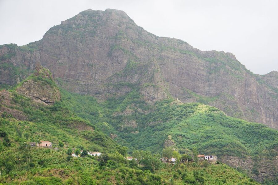
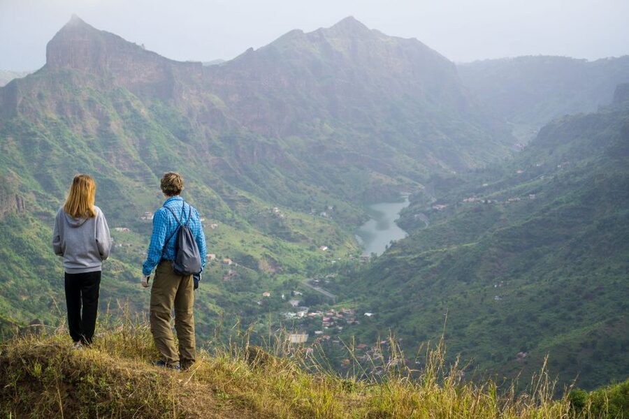
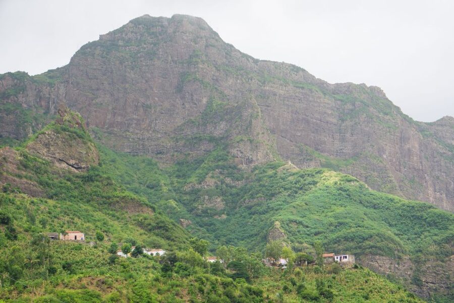
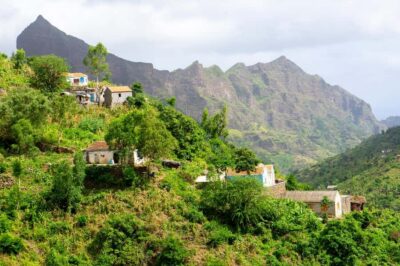
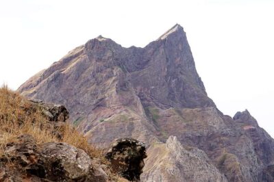
Serra Malagueta is one of Santiago’s best places for broad mountain views. From the upper sections, you look across jagged hills and folds of green land before beginning the long descent. The setting changes as you walk, which is one reason this route feels more substantial than a short viewpoint visit.
The early part also introduces you to local plants, including species found in the park. Keep your eyes open rather than rushing through the first kilometers. The guide can help explain what you are seeing, and the slower pace gives you a better chance of spotting birds.
Wildlife is possible but not guaranteed. Vervet monkeys may appear, and gray-headed kingfishers are among the birds you might see. These are not the sort of sightings to build your whole day around. Think of them as a bonus that rewards patience.
The views are a major strength, but the descent requires attention. A mountain scene can look easy from a distance. On the trail, loose or wet ground, steep slopes, and tired legs tell a different story. Use poles if you have them, and keep your feet under you rather than trying to match a fast guide.
The long descent through Gongon Valley
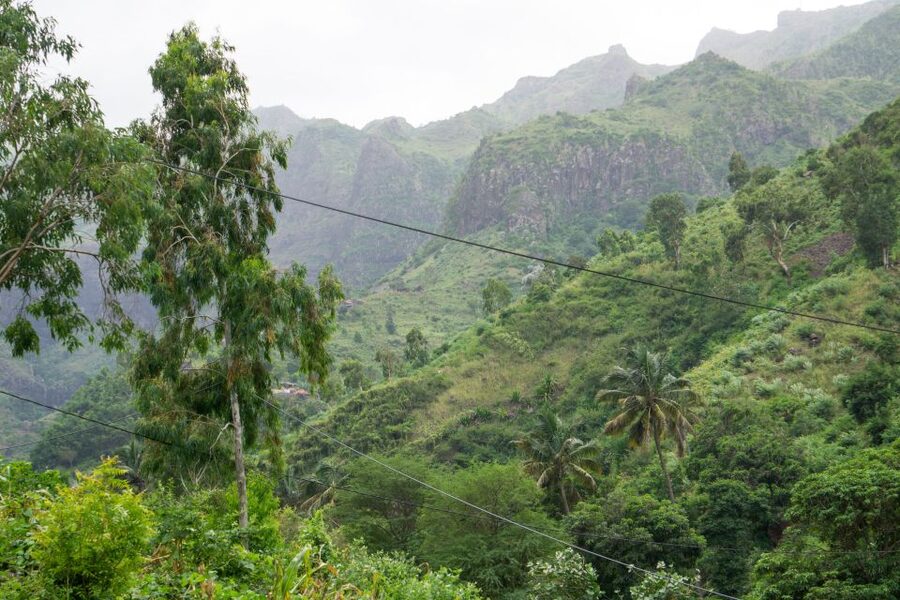
The trail leads downhill through Gongon Valley, where the character of the day shifts from high parkland to remote rural communities. The route includes both flatter stretches and steep downhill sections. The provided figures list about 580 meters of ascent but around 1,100 meters of descent, so your knees and thighs may feel the day more than your lungs.
This is where footwear matters most. Hiking shoes with firm grip are strongly recommended. One account described the hike as strenuous in the heat and said sturdy shoes and poles were essential. Another described rainy conditions that made the descent muddy and slippery.
I would not book this walk in casual trainers unless you are comfortable with a demanding trail and the ground is known to be dry. Hiking trousers are especially advised from August through November, when vegetation and weather can make bare legs uncomfortable. A small windbreaker is also sensible for rain or changing conditions.
The stated walking time is four to five hours, but pace can vary. One outing covered the distance in about three and a half hours, which felt too fast for at least one participant. That detail matters. A quick pace may suit a very fit hiker, but it can make the route less safe and less enjoyable for anyone who wants to stop for photos, watch birds, or recover on steep ground.
Remote villages and a meal with a local family
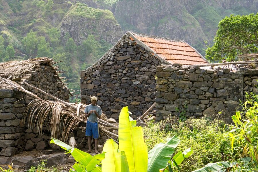
One of the most worthwhile parts of the route is passing deserted villages and meeting families who live in these mountain areas. This gives the hike a human side. You are not simply walking through scenery. You are seeing how people manage daily life away from Santiago’s main urban center.
The guide helps explain local ways of life and provides context for the homes and settlements along the route. The experience is brief and informal, not a staged cultural show. That is precisely its value. You get a small window into remote communities while moving through the valley on foot.
Lunch is planned with a local family. The basic meal description includes juice, fruit, and a sandwich, while some outings have included a more substantial local dish served at a family home. Food can therefore vary, and you should not expect a restaurant-style spread.
Most importantly, confirm the lunch plan with your guide at the start. One participant reported receiving only a quick papaya stop instead of the picnic described, while others had delicious food at Hermiña’s home. That contrast suggests that the meal may depend on the day, the host family, or the way the guide organizes the stop.
For me, the home meal is a key reason to choose this tour over a private drive to a viewpoint. But it is best to carry a small backup snack. That is not because lunch will necessarily be poor. It is because four to five hours of hard walking requires dependable fuel.
More walks:
- Santiago: Monte Tchota Natural Park to Pico d’Antónia Hike
★ 4.8 · 43 reviews - Serra Malagueta Natural Park Hike & Relaxing Swim at Tarrafal Beach
★ 5.0 · 30 reviews - Santiago Island: 4-Hour Calabaceira Valley Hike & Guided Tour to Cidade Velha
★ 5.0 · 18 reviews - Santiago: Trek from Serra Malagueta to Rabelados Community
★ 5.0 · 16 reviews
Continuing to Hortelã Valley
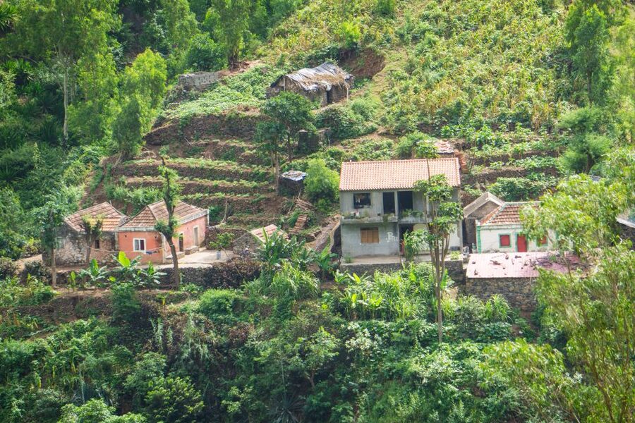
After the Gongon section and lunch, you continue east toward Hortelã Valley. By this point, the route has moved well below the high starting point, with the lowest elevation listed at about 110 meters. The changing altitude helps explain why the trail feels like a full crossing rather than a short park walk.
The lower valleys offer a different view of Santiago. Instead of looking out from a high ridge, you are moving among cultivated areas, settlements, and steep mountain sides. The walk connects places and communities in a way that a vehicle tour cannot.
The final portion may feel long if the heat is strong or your legs are already tired. Build in a steady rhythm from the beginning. Drink regularly, protect your head from the sun, and do not save all your water for later. The route finishes with transport back to Praia, so you can rest after the trail rather than face another long walk to your hotel.
How difficult is the Serra Malagueta hike?
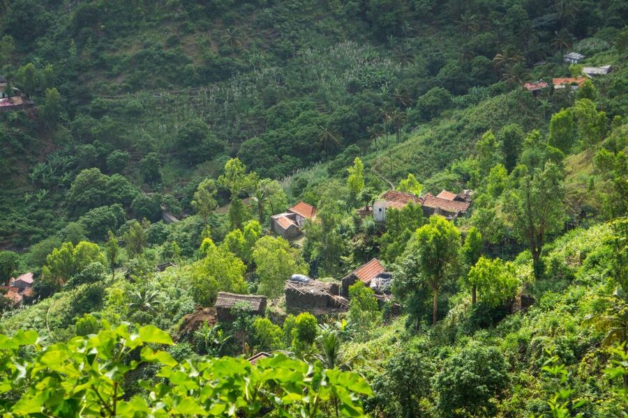
The official rating is difficult, and I would take that seriously. The distance is about 12.5 kilometers, the walking time is four to five hours, and the elevation loss is roughly 1,100 meters. Those numbers point to a demanding day even for a regular walker.
The heat adds another challenge. One participant described the hike as very strenuous because of the temperature, while others found it invigorating or accessible. Both reactions can be true. Fitness, weather, trail conditions, and group pace will shape your experience.
You should be comfortable with:
- Four to five hours on foot
- Long downhill stretches
- Steep and sometimes slippery ground
- Walking in heat or possible rain
- A route with no easy return to the starting point
You do not need to be an elite hiker, but you should have reasonable stamina and secure footing. If downhill walking bothers your knees, this may be a poor match. The route is not suitable for wheelchair users.
The guide’s handling of the group is important. José has been praised for explaining more than expected, and Katia or Cati has been described as especially kind and attentive. At the same time, one fast-paced outing left people behind and did not provide enough care after falls. Tell the guide early if you need a slower pace or a short rest. A good guide should know where the group is, not just where the trail goes.
What is included, and is $106 a fair price?
The price is $106 per person. It covers pickup and drop-off in Praia, transport, a guide, lunch, and liability insurance. The only listed extra is the Serra Malagueta Natural Park entrance fee, €2 per person.
That package has useful value if you are staying in Praia and would otherwise need to arrange a private vehicle, find the trail, hire a guide, and organize food. The local-family stop also adds something that a simple park transfer would not provide.
The price is less attractive if you mainly want a short scenic walk. This is a full-day outing built around a difficult one-way trail. You are paying for transport to a remote start, guiding across several valleys, and the practical work of moving you back to Praia.
Shared groups require at least two participants. If that minimum is not met, the operator may offer another date, charge an extra fee for a private departure, or cancel with a full refund. That condition is worth noting if your schedule is tight.
The tour can be reserved with payment later, and cancellation is allowed up to 24 hours before departure for a full refund. Those policies make planning easier, but they do not change the need to prepare properly for the hike.
What to pack for a safer, better day
Your packing list should focus on grip, sun protection, water, and weather.
- Hiking shoes with good traction
- Walking poles, especially for the steep descent
- A hat
- Sunscreen
- Plenty of water
- Hiking trousers, especially from August through November
- A small windbreaker for rain
- A snack in case lunch is lighter or later than expected
- €2 for the park fee
The tour includes lunch, but water is listed as something you must bring. Do not treat the included juice as your drinking supply for the day. Heat and downhill effort can catch you off guard.
Wear shoes before the tour, too. A long descent is a poor place to discover that your footwear rubs. Keep your camera handy, but do not let it distract you on uneven sections.
Who should book this experience?
I would recommend it to active visitors who want Santiago’s mountains, local communities, and a guided route in one day. It suits you especially well if you enjoy walking from one valley to another and prefer a human-scale cultural stop to a polished sightseeing circuit.
It is also a good fit for visitors without a rental car. Pickup, transport, and the return to Praia remove much of the planning burden.
I would hesitate if you dislike steep descents, struggle in heat, or want an easy half-day outing. I would also ask about the planned pace and lunch before departure. Those two details can shape the day more than the headline description suggests.
The high rating of 4.8 from 22 ratings reflects the strong combination of scenery, guides, food, and organization. The less favorable account is useful because it points to the main risk: a beautiful route becomes much harder when the group is pushed too fast or not watched closely.
Should you book the Serra Malagueta hike?
Book it if you want a demanding but rewarding day in Santiago’s interior, and if you are ready for 12.5 kilometers of mountain walking. The views, endemic plants, valley crossings, and family lunch give the experience real substance.
Before setting out, confirm the expected pace, lunch arrangement, and meeting details with the guide. Bring poles, proper shoes, water, and rain protection. If you prepare for a hard hike rather than a casual walk, this is a strong way to see a less visited side of Santiago.
FAQ
Where does the Serra Malagueta hike take place?
The experience takes place on Santiago Island in Cape Verde. The route passes through Serra Malagueta Natural Park, Gongon Valley, and Hortelã Valley.
How long is the trail?
The trail distance is approximately 12.5 kilometers.
How long do you walk?
Total walking time is approximately four to five hours.
Is the hike difficult?
Yes. It is rated difficult and includes flat sections as well as steep downhill stretches. The route has about 580 meters of elevation gain and roughly 1,100 meters of elevation loss.
What is the highest and lowest point?
The highest point is approximately 1,035 meters above sea level. The lowest point is approximately 110 meters.
Is the trail a loop?
No. The trail is one way, starting high in Serra Malagueta and continuing down through the valleys toward Hortelã Valley.
Is lunch included?
Yes. Lunch is included. The planned food includes juice, fruit, and a sandwich, and the stop may also include a local dish served with a local family.
What should I bring?
Bring a hat, hiking shoes, sunscreen, water, walking sticks, hiking trousers, and a windbreaker for possible rain. You should also bring €2 for the park entrance fee.
Is hotel pickup included?
Yes. Pickup and drop-off at your accommodation in Praia are included, along with transportation, a guide, lunch, and liability insurance.
More Lunch Experiences
- Praia: Guided Historic Walking Tour & Lunch with Locals
★ 3.8 · 9 reviews - Praia: Guided Historic Walking Tour & Lunch with Locals
★ 4.5 · 8 reviews - Tarrafal Beach Tour: Boat Trip to the Lighthouse, Snorkel & BBQ Lunch
★ 5.0 · 5 reviews - Sal Island: Guided Full-Day Highlights Tour with Lunch
★ 4.7 · 414 reviews
Just added around Praia
- Santiago Island: Private Airport Transfer to Praia or Vice Versa★ 5.0 · 3 reviews
- Cape Verde: Best Hikking Trails of Santiago Island – 6 Days★ 5.0 · 3 reviews
- Praia City Tours★ 3.4 · 3 reviews
- Hiking Águas Belas Cave★ 4.5 · 3 reviews
- Best of Santiago Island: Cidade Velha, Workshop & Tarrafal Beach Tour★ 4.5 · 3 reviews
- Tarrafal Bay Boat Trip and Beach Day★ 4.4 · 3 reviews
- From Praia: Full-Day Guided Fogo Island Tour★ 4.2 · 3 reviews
- Praia: Plateau and Cidade Velha Guided Tour★ 5.0 · 3 reviews
Hiking & Trekking, compared.

Serra Malagueta: Principal Valley Hike & Lunch with Locals
Read our review →
Baobab Mysterious Tree, Green Valley & Old City Hike
Read our review →
Monte Tchota Natural Park to Pico d’Antónia Hike
Read our review →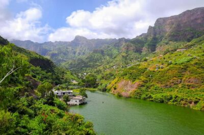
Browse the lists this tour appears in